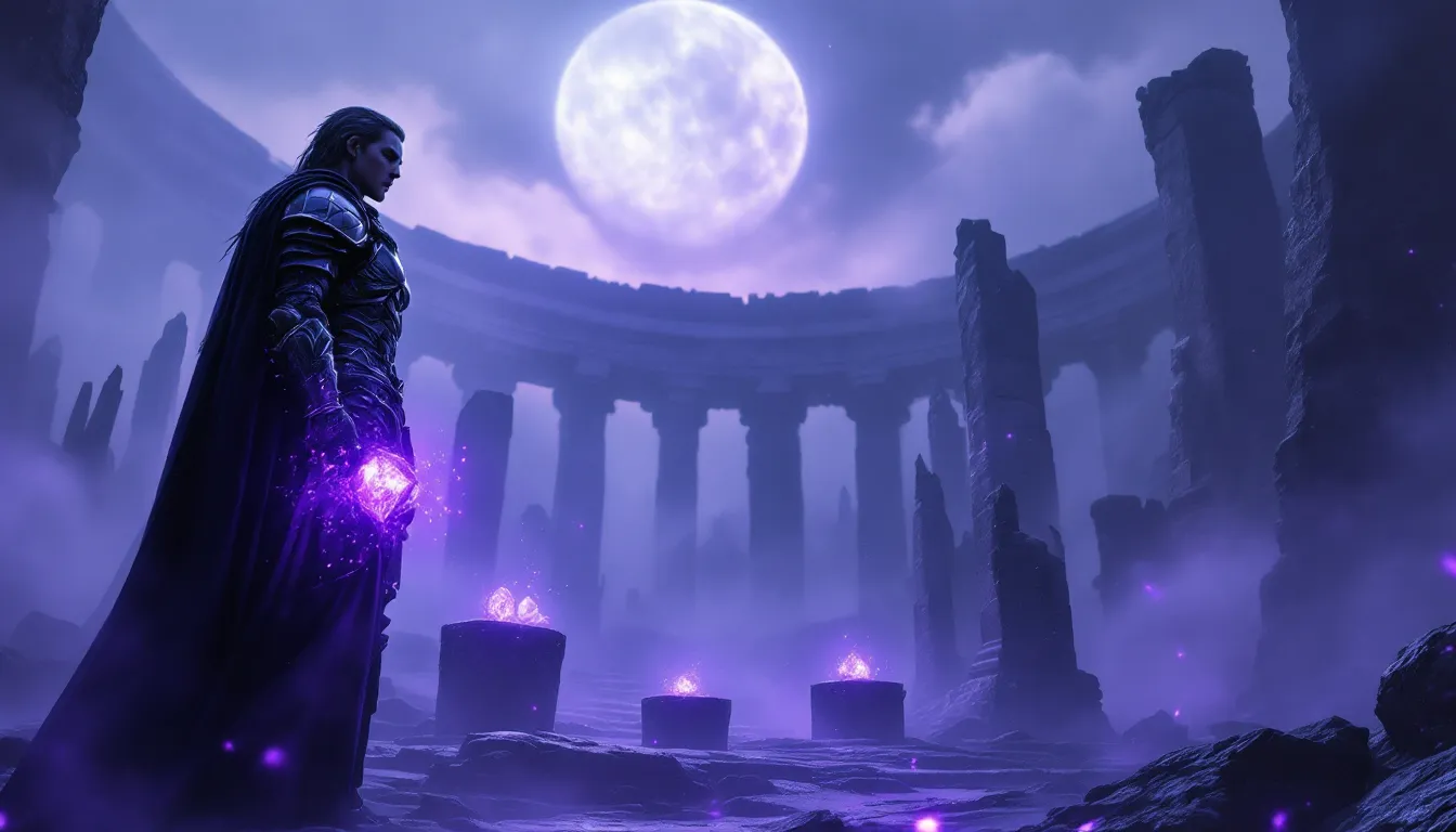
Fifteen years after launch, Skyrim’s landscape still stops players mid-sprint. That moment when the sun breaks through fog over Lake Ilinalta, or when a mammoth herd crosses the tundra against a mountain backdrop, these aren’t scripted setpieces. They’re the result of intentional, layered environmental design that holds up against games with ten times the budget and polygon count.
The Anniversary Edition and countless community updates keep Skyrim visually relevant in 2026, but the core landscape design from 2011 remains the foundation. From volcanic hot springs in Eastmarch to the alien glow of Blackreach’s massive caverns, the nine holds offer geography that’s distinct, memorable, and crucial to how the game feels to explore. This isn’t just about pretty screenshots. Terrain dictates combat tactics, weather systems create atmosphere, and regional biomes tell environmental stories before any NPC opens their mouth.
Whether players are returning after years away or diving in for the first time with a modded setup, understanding Skyrim’s landscape transforms the experience from a quest checklist into actual exploration.
Table of Contents
ToggleKey Takeaways
- Skyrim’s landscape design uses intentional radiant terrain layering and verticality to create distinct, memorable regions that serve gameplay, navigation, and environmental storytelling after 15 years.
- The nine holds—from Whiterun’s open plains to the Reach’s dramatic canyon networks—maintain unique geographic and climate identities that directly influence combat tactics, travel strategies, and exploration depth.
- Iconic locations like the Throat of the World, Blackreach, and Forgotten Vale showcase Bethesda’s advanced vertical level design and reward exploration beyond main quest markers.
- Dynamic regional weather systems, aurora effects, and environmental hazards (volcanic vents, falling snow, unstable terrain) transform Skyrim’s landscape into an active, engaging system rather than static background.
- Modern graphics mods like Cathedral Landscapes, Majestic Mountains, and Verdant enhance the base landscape while maintaining the stylized, readable aesthetic that made Skyrim’s geography functional and timeless.
- Skyrim’s landscape actively influences gameplay through terrain-based navigation challenges, strategic NPC positioning, and environmental clues that reward careful observation and support diverse playstyles.
Why Skyrim’s Landscape Design Remains Unmatched After 15 Years
Bethesda built Skyrim’s world using a technique called radiant landscape layering, terrain that reacts to altitude, climate zones, and proximity to water sources. The result is environmental variety that doesn’t feel copy-pasted. Walk north from Riften’s autumn forests and the trees gradually thin into Windhelm’s snowy expanse. Climb from Falkreath’s dense woods to the peaks above and vegetation shifts from pine to sparse tundra shrubs.
The landscape uses verticality better than most open-world RPGs from its era. The Throat of the World doesn’t just sit in the middle as a setpiece, it creates a rain shadow effect on the eastern side, explains why certain holds stay dry, and serves as a navigation landmark from anywhere in the world. Players can look up, spot the mountain, and know exactly where they are.
What separates Skyrim from generic fantasy environments is environmental storytelling baked into terrain. Ancient Nordic ruins sit on strategic high ground overlooking trade routes. Dwemer constructions occupy geologically stable areas near ore deposits. Forsworn camps cluster in the Reach’s defensible canyon networks. The landscape isn’t just backdrop, it’s the reason civilizations built where they did and why certain factions control specific territories.
Modern games often prioritize photorealism over readability. Skyrim’s stylized approach to rock formations, tree placement, and lighting means players can parse terrain at a glance. That matters when a dragon shows up and you need to spot cover, or when navigating by landmarks instead of GPS markers. The 2026 modding community continues building on this foundation precisely because the base design is so functional.
The Nine Holds: Understanding Skyrim’s Diverse Regional Geography
Whiterun Hold: The Heart of Skyrim’s Plains and Tundra
Whiterun Hold occupies the central plains, serving as the geographic and narrative hub. The landscape here is deliberately open, rolling tundra with scattered farms and minimal tree cover. This creates sightlines that let players see threats (or points of interest) from a distance, rewarding situational awareness over twitch reflexes.
The Western Watchtower and surrounding giant camps demonstrate how Bethesda uses terrain to create natural combat arenas. The slight elevation changes, rock clusters, and the tower itself provide cover options without feeling artificial. Players exploring the landscape and experimenting with different build approaches will notice how the open terrain favors ranged combat and mounted travel more than dense forest regions.
The climate stays temperate with frequent clear weather, making Whiterun Hold ideal for new players learning navigation mechanics. The landscape doesn’t punish exploration the way blizzards in Winterhold or volcanic ash storms in Solstheim do.
The Reach: Dramatic Cliffs and Ancient Forsworn Territory
The Reach is Skyrim’s most vertical hold, dominated by canyon networks and sheer cliff faces. The landscape here channels movement into specific paths, creating natural choke points that the Forsworn exploit. Players can’t just sprint in a straight line, navigation requires attention to switchbacks, rope bridges, and carved stone steps.
The vegetation shifts to hardy shrubs and sparse trees clinging to rocky soil. Kolskeggr Mine and the surrounding gold deposits sit exposed on cliff sides, forcing players into vulnerable positions during approach. The Reach’s landscape design teaches caution in a game that otherwise lets players ignore terrain.
What makes the Reach memorable is how it uses negative space. The deep canyons and towering rock formations create shadows and sightline breaks even at midday. Ambush predators (both wildlife and Forsworn) use this geography effectively, making the landscape feel actively hostile rather than just difficult to traverse.
The Rift: Autumn Forests and Volcanic Hot Springs
The Rift maintains perpetual autumn, with orange and red foliage that stands out against Skyrim’s predominantly green and white palette. The landscape here is dense forest broken by clearings around Riften and the volcanic features near Cradlecrush Rock.
The geothermal activity in the Rift creates hot springs and steam vents that add visual variety and explain why the hold stays warmer than its northern latitude suggests. These features aren’t just cosmetic, certain alchemy ingredients spawn specifically near thermal areas, rewarding players who explore the landscape thoroughly.
The forest density makes navigation more challenging than Whiterun’s plains, but the autumn color scheme prevents the visual monotony that can plague heavily forested game regions. Players can still pick out landmarks and maintain orientation even when tree cover blocks long sightlines. Those looking for comprehensive navigation strategies will find essential exploration tips useful in dense terrain like this.
Eastmarch: Volcanic Landscapes and Geothermal Wonders
Eastmarch contains Skyrim’s most dramatic volcanic features, centered around the active hot springs between Windhelm and Riften. The landscape transitions from snow-covered tundra near the capital to geothermally active zones with exposed rock and mineral deposits.
The sulfur pools near Cradlecrush Rock and Mixwater Mill create hazard zones where players take heat damage if they linger too long, one of the few examples of environmental hazards that actually threaten player health. The volcanic activity explains ore deposits and provides visual justification for Windhelm’s relatively warm climate even though its northern position.
Eastmarch’s eastern border features barren highlands that transition into Morrowind’s ashlands. This cross-border consistency shows environmental planning beyond individual hold boundaries, making the world feel geographically coherent rather than a collection of isolated biomes.
The Most Iconic Landscape Locations Every Player Must Visit
The Throat of the World: Skyrim’s Towering Peak
The Throat of the World stands at 766 meters according to in-game measurement tools, making it the tallest mountain in Tamriel. The ascent from Ivarstead to High Hrothgar showcases Bethesda’s vertical level design, the landscape shifts from temperate forest to alpine tundra to bare rock and snow over a distance that feels earned through actual climbing.
The Notched Pickaxe location on the summit references Minecraft’s creator, but more importantly demonstrates how the landscape rewards exploration beyond main quest markers. Players who deviate from the Greybeard’s stone path discover alternate routes, hidden shrines, and environmental storytelling through skeleton placement and abandoned campsites.
The summit provides 360-degree visibility of the entire map on clear days. Players can identify all nine hold capitals from this vantage point, reinforcing the peak’s role as geographic anchor. The thin atmosphere causes a unique lighting effect at sunrise and sunset that modders frequently reference when building custom weather systems.
Blackreach: The Underground Alien Cavern System
Blackreach remains one of gaming’s most memorable underground environments fifteen years later. The massive Dwemer cavern spans multiple zones beneath Skyrim’s surface, featuring bioluminescent fungi, an artificial sun, and architecture that predates the Nordic kingdoms by thousands of years.
The landscape design here breaks from surface-level geography rules. Glowing mushrooms the size of trees create vertical landmarks in what could have been monotonous cave systems. The Crimson Nirnroot that only spawns in Blackreach forces completionists to explore every corner of the underground landscape, turning optional content into a navigation challenge.
What makes Blackreach work is scale. The cavern ceiling sits high enough that players lose depth perception, creating an unsettling open feeling even though being underground. The Dwemer architecture rises from the cavern floor like skyscrapers, with functional elevators connecting to surface locations across multiple holds. Platforms hosted on modding communities feature dozens of Blackreach expansion mods that build on this unique landscape foundation.
Forgotten Vale: The Hidden Snow Elf Sanctuary
Forgotten Vale, accessed through the Dawnguard DLC, represents Bethesda’s most refined landscape design. The hidden valley exists outside normal map boundaries, accessible only through Darkfall Cave, creating a sense of discovery that the main map can’t replicate after the first playthrough.
The Vale features frozen waterfalls, ancient wayshrines, and the Glacial Crevice, a massive ice formation that players can actually enter and navigate. The landscape tells the story of the Snow Elves’ fall without dialogue or quest markers. Ruined structures sit frozen in ice, the Chantry of Auri-El dominates the skyline, and the environment itself shows signs of both reverence and decay.
The Sharpslope Cave and surrounding ice formations demonstrate advanced collision detection and climbable geometry that the base game rarely uses. Players can scramble up near-vertical ice walls, creating shortcuts and alternate approaches that reward careful observation of the landscape rather than following predetermined paths.
How Weather and Lighting Transform Skyrim’s Environment
Dynamic Weather Systems and Regional Climate Patterns
Skyrim’s weather uses regional probability tables that shift based on hold, altitude, and proximity to water. Winterhold experiences blizzards 60% more frequently than Falkreath, while coastal areas near Solitude see more fog and rain than interior holds. This isn’t random, each hold has distinct climate data that creates consistent atmospheric identity.
The lighting engine prioritizes readability over realism. Overcast weather doesn’t plunge the world into gameplay-disrupting darkness, and even blizzard conditions maintain enough visibility for basic navigation. This design choice prevents weather from becoming a frustration factor while still creating atmosphere.
Snow accumulation varies by region and weather duration. Fresh snowfall in Winterhold can temporarily obscure ground-level details, creating the visual impression of shifting landscape even though the underlying geometry stays constant. The effect resets after fast travel or cell changes, but in the moment it adds environmental dynamism that 2011-era tech shouldn’t have managed.
Players optimizing their visual experience often reference performance analysis from sources like DSOGaming when choosing weather overhaul mods that maintain both atmosphere and frame stability.
The Aurora Borealis: Skyrim’s Most Beautiful Natural Phenomenon
The Aurora Borealis appears in northern holds on clear nights, rendered as animated texture layers that shift across the sky. The effect uses minimal performance overhead but creates one of the game’s most screenshot-worthy moments. The aurora’s green and purple bands reflect off snow, water surfaces, and even character armor, adding indirect lighting that changes the nighttime landscape entirely.
The aurora system doesn’t just activate randomly, it follows celestial mechanics tied to Skyrim’s dual moons and constellation system. Players who track Masser and Secunda positions notice aurora frequency correlates with specific lunar phases, adding mechanical depth to what appears to be pure aesthetics.
Modders have built entire weather overhauls around improving the aurora effect, adding color variation, intensity scaling, and even integration guides for syncing aurora appearances with player actions. The base game implementation, though limited by 2011 hardware, established the framework that keeps the northern lights as Skyrim’s signature atmospheric feature in 2026.
Best Landscape Mods to Enhance Your Visual Experience in 2026
Graphics Overhaul Mods for Next-Gen Landscape Detail
Cathedral Landscapes remains the performance-friendly choice for players who want noticeable improvement without tanking framerates. The mod replaces low-resolution terrain textures with 2K versions, adds 3D ground cover, and improves LOD (level of detail) transitions so distant mountains don’t pop in jarringly. It stays lore-friendly rather than turning Skyrim into a tropical paradise or alien world.
Majestic Mountains specifically targets Skyrim’s rock formations and peaks, the most visible landscape elements from any position. The mod adds geometric detail to cliff faces, improves normal mapping for better lighting interaction, and includes compatibility patches for weather mods. Players running high-end rigs in 2026 can push settings to 4K with parallax mapping enabled, creating rock surfaces with actual depth.
Tamriel Reloaded takes a comprehensive approach, overhauling mountains, roads, bridges, and Dwemer ruins in a single package. The visual style stays consistent with vanilla Skyrim while dramatically improving texture resolution and environmental detail. Load order matters, Tamriel Reloaded should load before weather and lighting mods to prevent texture conflicts.
Skyland AIO (All-In-One) bundles landscape, architecture, and dungeon texture improvements into one download. The 2026 version includes next-gen console support and performance profiles for Steam Deck. The visual upgrade is immediate and comprehensive, though purists may find some textures too clean compared to Skyrim’s weathered aesthetic.
Flora and Fauna Enhancement Mods
Flora Overhaul remains essential for players who want denser, more varied vegetation without script-heavy mechanics. The mod places trees, shrubs, and ground plants based on regional biome data, so the Rift gets thicker autumn forests while the Reach stays appropriately sparse. Performance impact exists but stays manageable on mid-range hardware.
Enhanced Landscapes adds geographical features the base game lacks, rock cairns, fallen logs, additional boulders, creating visual interest in areas that felt empty. The mod doesn’t alter navmesh, so NPCs and followers navigate correctly without pathing issues. Compatibility with city overhauls requires patches, but most major mods include them.
Verdant specifically targets grass and ground cover, adding grass variety and density that responds to regional climate. The 2026 version includes seasonal variation that shifts grass color based on in-game date, creating subtle visual progression that makes long playthroughs feel more dynamic. Players using modding utilities will find Verdant easy to configure through MCM menus.
Skyrim Flora Overhaul SE improves tree models with better bark textures, branch geometry, and leaf placement. Trees cast more realistic shadows and react properly to weather effects like wind and snow. The visual upgrade makes forest navigation more challenging (denser canopy means less visibility) but dramatically improves screenshots and general atmosphere.
Photography Tips: Capturing Skyrim’s Most Stunning Vistas
TFC command (toggle free camera) remains the foundation of Skyrim photography. Opening the console with tilde (~) and typing “tfc 1” freezes time and character animations while allowing camera movement in all directions. This lets photographers position shots without NPCs wandering through frame or dragons interrupting the moment.
Time of day transforms the same location completely. The golden hour (first hour after sunrise, last hour before sunset) provides warm, directional lighting that brings out terrain detail and creates long shadows. Midday lighting is flat and uninteresting. Night shots work best with aurora activity or moonlight reflecting off water or snow.
Weather control through console commands (“fw 10e1ec” for clear, “fw 81a26” for rain) lets photographers choose atmospheric conditions. Fog adds depth and mystery to forest shots. Fresh snowfall creates texture on rocky surfaces. Rain adds reflections and dramatic cloud cover. Knowing specific weather IDs saves time compared to waiting for natural cycles.
FOV adjustment through console or ini files controls how much landscape fits in frame. Lower FOV (60-70) creates compressed perspective that makes mountains look more imposing. Higher FOV (90-110) captures wide vistas but can distort edges. Players should experiment with FOV based on the specific landscape feature they’re shooting.
ENB presets dramatically alter Skyrim’s color grading and post-processing. Presets like Rudy ENB or Silent Horizons emphasize landscape detail through improved ambient occlusion, depth of field, and color correction. The 2026 ENB builds include performance modes that maintain visual quality on mid-range systems. Comparing these setups against curated mod lists helps photographers choose configurations that match their aesthetic goals.
Composition rules from real photography apply: rule of thirds for horizon placement, leading lines using roads or rivers, foreground elements to create depth. Skyrim’s landscape provides natural framing through rock formations, tree branches, and architectural ruins. The best shots use these elements to guide the viewer’s eye toward the focal point rather than centering everything symmetrically.
How Skyrim’s Landscape Influences Gameplay and Exploration
Terrain Navigation and Travel Strategies
Horse physics change completely based on terrain. Horses can climb near-vertical surfaces that would require careful jumping on foot, making them essential for efficient mountain travel. The trade-off is reduced combat effectiveness, players on horseback can’t block, dodge, or use magic effectively. The landscape design encourages mounting up for travel and dismounting for encounters.
Fast travel from any outdoor location removes navigation challenge entirely, but players who disable it discover how well the landscape supports organic exploration. The road network connects all major cities with actual pathing that NPCs follow. Following roads guarantees safe(r) travel at the cost of time compared to direct cross-country routes.
Sprinting stamina management becomes crucial in mountainous terrain. Jumping consumes stamina faster than running, and depleted stamina prevents power attacks in sudden combat. The landscape punishes button-mashing in favor of measured movement, finding natural paths up slopes instead of forcing direct vertical climbs.
Fall damage scaling makes height awareness essential. A drop that barely scratches health in Whiterun’s plains can kill in the Reach’s canyon networks. The landscape teaches players to judge safe descent distances or use terrain features (ledges, slopes, water) to break falls safely. Restoration spells or health potions before risky jumps become standard practice.
Environmental Storytelling Through Landscape Design
Bandit camp placement follows logical defensive positions, high ground overlooking roads, cave entrances with clear sightlines, ruins with existing fortifications. The landscape tells players these locations were chosen strategically, not randomly spawned. Approaching camps from unexpected angles (above via mountain paths, below via river approaches) exploits this geography.
Dragon burial mounds sit on exposed hilltops and open tundra where massive creatures could land and be interred. The landscape around each mound shows scorch marks, displaced earth, and scattered bones, environmental evidence of ancient battles. This level of detail rewards players who observe surroundings instead of tunnel-visioning on quest markers.
Dwemer ruins occupy geologically stable areas near ore deposits, waterfalls (for power generation), and geothermal features. The landscape context explains why ancient Dwemer built specific locations rather than treating ruins as random dungeon spawns. Observing these patterns helps players predict where undiscovered Dwemer sites might exist. Many players developing custom playthroughs use these environmental clues to create self-directed exploration goals.
Environmental hazards like rockslides in the Reach, thin ice over deep water in Winterhold, and geothermal vents in Eastmarch make landscape observation a survival mechanic rather than just aesthetic appreciation. The world actively threatens careless movement in ways most open-world RPGs avoid.
Conclusion
Skyrim’s landscape endures because Bethesda prioritized geography that serves gameplay, navigation, and environmental storytelling simultaneously. The terrain isn’t just pretty, it’s functional, readable, and intentionally designed to support the exploration systems that define the game.
The nine holds maintain distinct visual and gameplay identities even after hundreds of hours. The Reach doesn’t play like the Rift, and Eastmarch’s volcanic hazards create different navigation challenges than Winterhold’s blizzards. This regional diversity keeps exploration engaging across massive playtimes that would turn most open worlds into repetitive grinds.
The 2026 modding scene continues building on this foundation precisely because the base landscape design is so solid. Graphics overhauls and weather systems enhance what’s already there rather than replacing fundamentally broken systems. New players in 2026 experience a visual standard competitive with modern releases, while veterans can return to landscapes they know intimately and still discover new details.
The landscape isn’t background scenery. It’s the reason combat encounters flow the way they do, why certain builds excel in specific regions, and how environmental storytelling communicates lore without quest text. Fifteen years later, Skyrim’s world still demonstrates how thoughtful geography elevates an open-world RPG from good to generationally significant.